
Forfatter: Geoff Corner |
 |
 |
|
| Berggrunnsgeologi |
Løsmasser |
Landskapet | Spor etter istiden | Eldre havnivå |
Bruk av geologien |
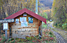
Practical informationSteindalen is located on the eastern side of the Lyngen Peninsula, south of Lyngsdalen and Furuflaten. From Oteren, drive north for c. 17 km on the west side of Storfjorden to just past Storeng. Cross the bridge over Steindalselva and turn left up a steep gravel path between the houses. This path leads to a community house and a small car park. The walking track up Steindalen begins here. 
Allow at least 2 hours for the trip to the glacier, and 1½ hours for the return journey. Including stops, the trip takes about 6-7 hours. Waterproof boots are recommended. |
|